Monday, September 24, 2007

Spam for the road

I just saw Non-Stop Ads truck when driving through Fresno. An unusual idea. Cost effective? Effective for advertisers? I don't know.. Kind of cool to see something like this being done locally.

Tuesday, September 11, 2007

Welcome to TechShop

This is a seriously good idea (via Guy Kawasaki's blog). TechShop offers a fully tooled shop for anybody who wants to build/invent stuff. It's "Mythbusters" for the rest of us. The prices are very reasonable. If I spend any time at all in my garage I know I end up spending $100/mo in misc stuff at Home Depot--and without access to all the cool tools.

I hope this kind of thing is profitable enough that it will find franchises in other cities (like Fresno).

Monday, September 10, 2007

Defeat at Park Ridge

All trails are created equal on the Hume Lake Ranger District's OHV map. There's a legend on that map that includes some notable trails. And some of those I've already been on this summer were much less challenging that the map made them sound.

Thus I didn't expect much of a challenge when we ventured over to the other side of the highway towards Hume Lake via the Cherry Gap. The map shows Indian Basin Road running nearly parallel to Park Ridge Road. In fact, if you had to judge the terrain from the line on the map, you'd say Park Ridge was the smoother ride of the two. Indian Basin to Park Ridge and back to Huckleberry Trail looked like a nice little loop. Judging by the topographical data, we'd have a good view from Park Ridge, and we'd be back on the highway in time for a quick trip up to Boyden Cave.

The boys and I had a leisurely drive through Indian Basin, stopping at several points along the way to stretch our legs, catch a grasshopper, count the rings in a fallen tree (112), and drink coffee.

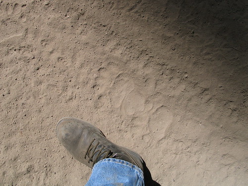
I should have known something was afoot as soon as I made the turn onto Park Ridge. Unlike other forest service roads, this one is marked with orange triangles on the trees, sometimes pointing in the direction you're supposed to go, lest the lack of a clear path lead you astray. The road was well traveled, jeeps have been here, but each little hill climb became more challenging than the last, until finally my poor factory equipped truck was stopped dead in its tracks. The picture above was taken when we were already at about a 30 degree angle--so it's hard to appreciate how steep this last bit really was. The rock at the top has a lot of very loose dirt under it, and there's no way around.

As I pointed out in my last post, I've spent the summer exploring every road on the map--and nothing's been a serious challenge. Now I feel like a house cat behind a closed door--and I know a road exists on this map that I can't travel (yet).

Saturday, September 01, 2007

Ursus' Trail

The boys and I (and the wife from time to time) have spent the summer exploring the Millwood area in the Sequoia National forest. We've been following the official OHV (off highway vehicle) map and have been sure to adhere to the rules regarding where we should/shouldn't recreate with our particular class of 4wd vehicle.

I've been obsessed all summer. I can't stand the thought that there's a trail I haven't explored. My Tundra's paint has suffered for every brush infested trail I've discovered on the map (it's not scratched, it's "patina"). We've even run into the odd set of bear tracks (pictured above).

In my defense, I've been on the lookout for good camping spots. I've decided to write down some notes, and post them for everybody's benefit.

Davis Flat Road at Davis Flat. This area is probably most conveniently accessed via the Kings River side. The south half of Davis Road can be slow going. The best camping appears to be where the Davis Trail intersects the road. Not good for camping during the dry months, but looks like a nice spot during the spring. The

Millwood Staging Area. There are several easily accessed camp sites along the road off of Highway 180 and into the Millwood Staging Area. At the staging area, there are sites next to Mill Creek and a nearby forest service toilet. But off the beaten path about 100 yards to a East is a less obvious camp site on the edge of Mill Creek and a smaller stream that joins from the south. This is a lovely spot with a forest service picnic table and a fire ring. You'll have to pack your gear the last 100 yards, but the staging area is easily accessed by car.

Goodmill at Millwood Loop. These roads are in relatively flat areas and intersect perennial streams in several places. There are nice spots to camp on the east side of Mill Flat Creek a few hundred yards to the southeast of the point where Goodmil intersects Millwood Loop. The intersection is most easily accessed via Millwood Loop road, although that does require a good sized crossing of Mill Flat Creek that might be interesting when the water is high. Otherwise, access from Goodmill requires a steep descent a thousand feet or so that can get hairy in certain places. In general, the terrain at the bottom is more chaparral than alpine forest, so the area might be dry and boring during the summer months but lovely during the spring. Go during the late fall or early spring and explore lots of sites where several creeks intersect in the valley and combine into Millwood Creek on their way to the Kings River.

Goodmill at Abbot Creek (south of Shay Rail Road). There is a fantastic area where Abbot Creek (the actual creek, not the road) intersects Goodmill road a bit south of the point where Shay Rail Road (really an ATV-only track) intersects Goodmill. This is the point where Abbot Creek flattens out into the valley between Verplank Ridge and McKenzie Ridge. There is a nice USFS camp site in the meadow immediately after crossing Abbot Creek. Accessed most easily from Goodmill.

Dorsey Meadow. Midway up the Dorsey Meadow road from the Millwood Staging Area the road just brushes the corner of the Sequoia National Park and the General Grant area. The intersection is marked by many Giant Sequoia stumps. Turn to the right shortly after the (unmarked) 13S63A. There is a fantastic spot to camp surrounded by giant stumps and the remnants of ancient Sequoia's laying where they were shattered a hundred years ago. There's a small perennial stream that slows to trickle during the summer. Hiking along the trial up the stream leads you into the Grant Grove area via "the back way." Live Giant Sequoia are just beyond the park boundary line. It's wonderful to see these trees literally off the beaten path and as they must have stood a thousand years ago. This is a well secluded camp site with lots to do and see nearby.

Abbot Creek road at Abbot Creek. Abbot Creek road is a nice 20 minute drive that doesn't require 4 wheel drive most of the year. The road intersects its name sake at a sharp bend and gives way to a handful of fantastic camp sites, the lower of which is immediately beside the creek where it comes out from under the road. The creek is raging during the spring. This is an out-of-the-way but popular spot and is nicely situated with ATV access to the Millwood area as well as the Chicago Stump area.

Chicago Stump. There are several good spots to camp right off 180 along Chicago Stump Road where it intersects Abbot Creek Road. These are easily accessed and popular spots with the camper trailers and fifth wheel campers. During the summer months Chicago Stump Road gets pretty dusty and is a popular staging area for ATVs and motorcycles.

Hoist Ridge at Verplank Creek. Hoist Ridge and Verplank Ridge (along Chicago Stump Road) is a fantastic drive, but with surprisingly few places to camp. The turn at Verplank Creek gets honorable mention.

Software and Wine?

Brent writes about the benefits of Resveratrol found in grapes and red wine. I've contemplated changing this blog to "Software and Wine" because of red wine's benefits. But to achieve the high doses of Resveratrol that these mice in recent studies were given, I'd need to drink 750 to 1,500 bottles of red wine each day. That is decidedly bad for the software..