Ursus' Trail
 The boys and I (and the wife from time to time) have spent the summer exploring the Millwood area in the Sequoia National forest. We've been following the official OHV (off highway vehicle) map and have been sure to adhere to the rules regarding where we should/shouldn't recreate with our particular class of 4wd vehicle.
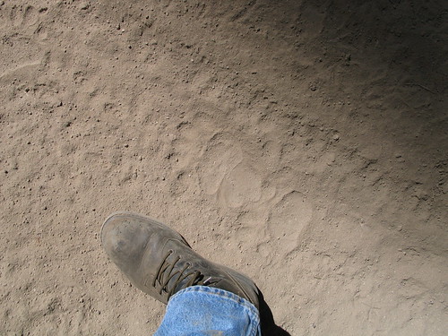
I've been obsessed all summer. I can't stand the thought that there's a trail I haven't explored. My Tundra's paint has suffered for every brush infested trail I've discovered on the map (it's not scratched, it's "patina"). We've even run into the odd set of bear tracks (pictured above).
In my defense, I've been on the lookout for good camping spots. I've decided to write down some notes, and post them for everybody's benefit.
Davis Flat Road at Davis Flat. This area is probably most conveniently accessed via the Kings River side. The south half of Davis Road can be slow going. The best camping appears to be where the Davis Trail intersects the road. Not good for camping during the dry months, but looks like a nice spot during the spring. The
Millwood Staging Area. There are several easily accessed camp sites along the road off of Highway 180 and into the Millwood Staging Area. At the staging area, there are sites next to Mill Creek and a nearby forest service toilet. But off the beaten path about 100 yards to a East is a less obvious camp site on the edge of Mill Creek and a smaller stream that joins from the south. This is a lovely spot with a forest service picnic table and a fire ring. You'll have to pack your gear the last 100 yards, but the staging area is easily accessed by car.
Goodmill at Millwood Loop. These roads are in relatively flat areas and intersect perennial streams in several places. There are nice spots to camp on the east side of Mill Flat Creek a few hundred yards to the southeast of the point where Goodmil intersects Millwood Loop. The intersection is most easily accessed via Millwood Loop road, although that does require a good sized crossing of Mill Flat Creek that might be interesting when the water is high. Otherwise, access from Goodmill requires a steep descent a thousand feet or so that can get hairy in certain places. In general, the terrain at the bottom is more chaparral than alpine forest, so the area might be dry and boring during the summer months but lovely during the spring. Go during the late fall or early spring and explore lots of sites where several creeks intersect in the valley and combine into Millwood Creek on their way to the Kings River.
Goodmill at Abbot Creek (south of Shay Rail Road). There is a fantastic area where Abbot Creek (the actual creek, not the road) intersects Goodmill road a bit south of the point where Shay Rail Road (really an ATV-only track) intersects Goodmill. This is the point where Abbot Creek flattens out into the valley between Verplank Ridge and McKenzie Ridge. There is a nice USFS camp site in the meadow immediately after crossing Abbot Creek. Accessed most easily from Goodmill.
Dorsey Meadow. Midway up the Dorsey Meadow road from the Millwood Staging Area the road just brushes the corner of the Sequoia National Park and the General Grant area. The intersection is marked by many Giant Sequoia stumps. Turn to the right shortly after the (unmarked) 13S63A. There is a fantastic spot to camp surrounded by giant stumps and the remnants of ancient Sequoia's laying where they were shattered a hundred years ago. There's a small perennial stream that slows to trickle during the summer. Hiking along the trial up the stream leads you into the Grant Grove area via "the back way." Live Giant Sequoia are just beyond the park boundary line. It's wonderful to see these trees literally off the beaten path and as they must have stood a thousand years ago. This is a well secluded camp site with lots to do and see nearby.
Abbot Creek road at Abbot Creek. Abbot Creek road is a nice 20 minute drive that doesn't require 4 wheel drive most of the year. The road intersects its name sake at a sharp bend and gives way to a handful of fantastic camp sites, the lower of which is immediately beside the creek where it comes out from under the road. The creek is raging during the spring. This is an out-of-the-way but popular spot and is nicely situated with ATV access to the Millwood area as well as the Chicago Stump area.
Chicago Stump. There are several good spots to camp right off 180 along Chicago Stump Road where it intersects Abbot Creek Road. These are easily accessed and popular spots with the camper trailers and fifth wheel campers. During the summer months Chicago Stump Road gets pretty dusty and is a popular staging area for ATVs and motorcycles.
Hoist Ridge at Verplank Creek. Hoist Ridge and Verplank Ridge (along Chicago Stump Road) is a fantastic drive, but with surprisingly few places to camp. The turn at Verplank Creek gets honorable mention.
posted by Steve at 6:58 AM
![]()
3 Comments:
You might also want to try using a mountain bike more during these adventures. It helps the rest of us breathe easier...
Hey do you know if the gates at Millwood are still open?
They were still open last I was up there two weeks ago. That was before the last storm--so they might have closed it. They're typically closed right around this time of year. But I suspect that depends on precipitation. Best thing to do is call the Hume Lake Ranger District station at 559-338-2251 and ask.
Post a Comment
<< Home